#365daysofbiking A total bore

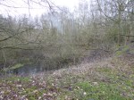
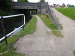
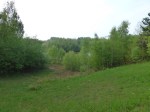
Thursday February 18th 2021 – Haring around Chasewater dam on a working from home exercise ride – for once in the daylight – I nearly came a cropper.

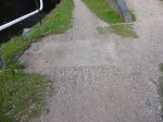
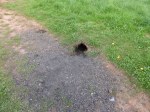
I was a shade off catching my pedal on this protruding piece of steel pipe.

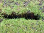
It has a close fitting cap and is padlocked shut.

This erstwhile cyclist and walker boobytrap is not some idle lump of former mining equipment stuck in the ground, or a piece of scrap the local tatters have missed – but a monitoring well for the land around.

Ground engineers monitor the area around Chasewater Dam for groundwater pollution and signs that the dam may be leaking. To do that they have a number of these bores, drilled and sleeved, which are dipped and monitored regularly for changes in water level and the chemical composition of the water within.

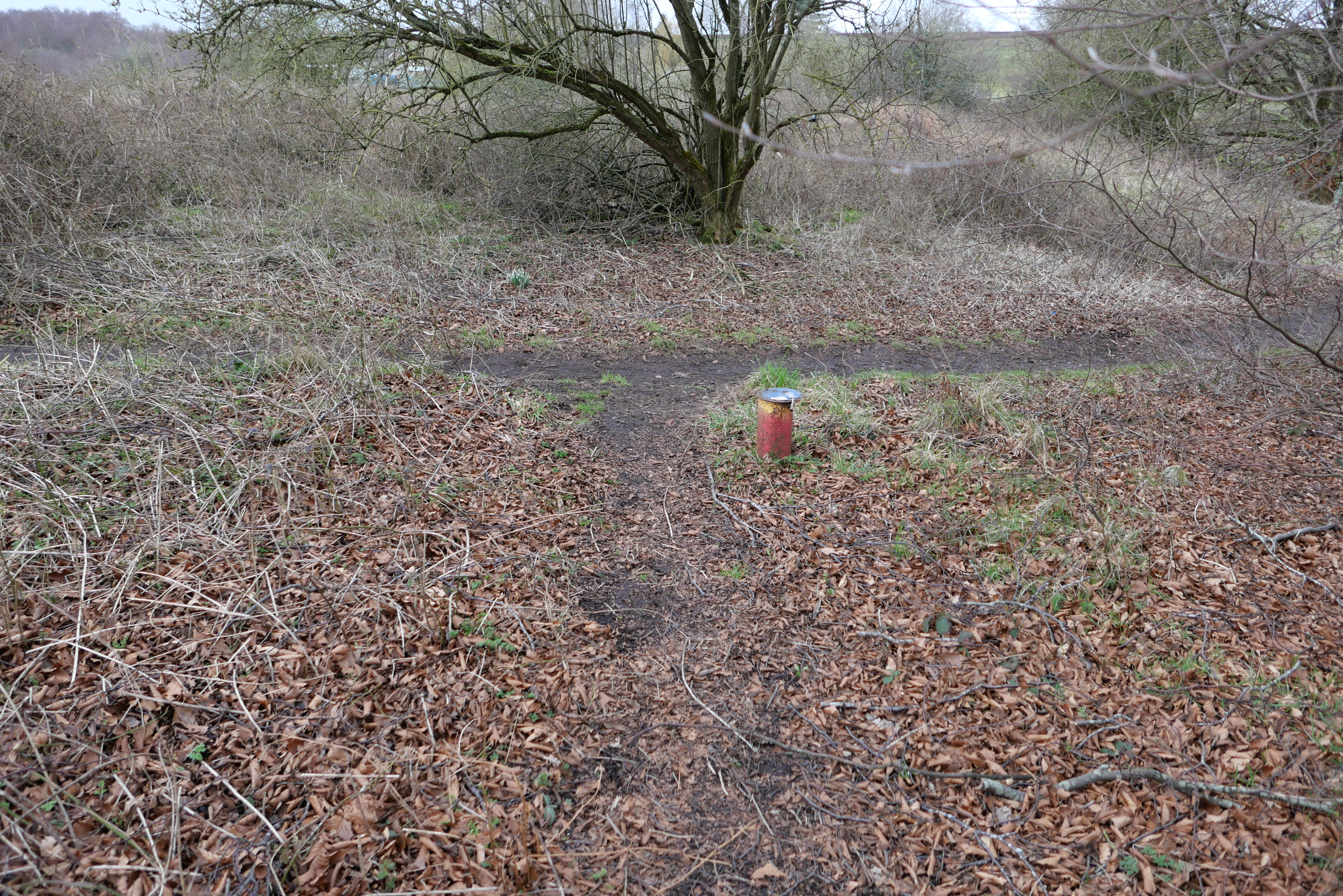
These are a familiar sight around Chasewater, but also many of the public open spaces in the area that require ground monitoring – like Brownhills Common, Shire Oak Nature Reserve and Clayhanger Common.

So mind your step and watch out when cycling off road: They are quite sturdy and not very forgiving…

from Tumblr https://ift.tt/2Nma7lr
via IFTTT

May 29th – In the meadow behind Alder Mill, just north of Atherstone, this pair of huge black cocks.

I have no idea, but just like imagining the faces of hopeful Googlers finding this post at some point in the future and being somewhat disappointed.

Interestingly, these cocks are only a a few hundred yards from a place called King Dick’s Hole.

Think I’m joking? Check a map.

April 5th – At Chasewater, a sinkhole has opened up in the car park, yards from the M6 Toll. Possibly an old shallow bell pit, it could just the same be an old drain or other cavity.

Site notices say experts from the Coal Authority are looking into it. As they do.

Never, ever trust the ground beneath your feet.

February 1st – Just on the rough side of Brownhills Common, a handful of yards from Coppice Lane, there’s a deep void in the land through the trees It may be the remnant of early surface mining, or the later evidence of hamfisted mineral exploration (the coal here was evident on the surface, so it was said; the grey clay also highly prized by potters), but it’s been here for decades; the spoil is piled up around it in mounds with fairly mature trees growing from them, which must date from around 1977, as the year previously, the whole of this side of the common had been flatted by a grassfire.

Every landscape tells a story This one tells of an industrial, blighted past, which we now sort of revere.

Brownhills holds some of it’s oldest secrets closest, but in plain sight.

June 13th – Credit where it’s due, several people (including myself, and I know @TheStymaster) complained about the water damaged towpath at Anchor Bridge last week.

Following heavy rains, the hardcore always washes out from either side of this concrete block, leaving a 6 inch void either side that can easily cause a pedestrian or cyclist to fall or injure themselves. It’s a recurring problem, and the Canal & River Trust appear to have sent someone out during the week to fix the damage.

It’s not a permanent fix – the loose material has just been shovelled back in, and first heavy rain, it’ll wash out again – but at least it’s safe for now. This needs a much better solution in the long term (like compacting properly, and maybe mixing in a little cement), but well done for filling the hole.

May 24th – Still feeling a bit ropey, and with dreadful weather, I didn’t get out until late afternoon when the sun decided to make an appearance. Sadly, the heavy rains have again blathered the towpath at Anchor Bridge. Where the water streams down the embankment, the shale footpath has washed from the side of the concrete drain cover again,leaving an 8-10 inch deep channel, 6 inches wide across nearly the full width of the towpath.

This is deep and large enough to wedge a bike wheel in, or lose a foot down – especially with inexperienced cyclists or kids. Take care. The rest of the path northwards to the bridge is also eroded badly and is quite hazardous.

Horridly enough, that’s a used syringe in cavity. I suspect it washed down with the storm water, possibly out of a drain. 

I shall contact the CRT on Tuesday.

January 26th – Beware, canal towpath walkers and cyclists. As pointed out by Warren Parry on Facebook a week or so ago, the brickwork on the embankment edge of the Wyrley and Essington Canal between Catshill Junction and the Silver Street Bridge in Brownhills is falling away.

A considerable cavity is opening between the towpath and the edging brickwork, large and deep enough to take a bike wheel or foot. I guess it’s caused by a combination of the weather and general erosion.

I shall contact the Canal & River Trust tomorrow to report the problem. In the meantime, watch where you’re going!

May 20th – On my way home tonight, I hopped onto the canal towpath to enjoy the pleasant evening and see if we had any cygnets yet. Sadly, the swans still seem to be sitting, but I did notice how green and lovely the new pond was looking at Clayhanger. It was wearing it’s summer jacket gloriously well.

This site used to be a spoil heap from Walsall Wood Colliery, consisting mainly of grey clay, coal washings, slack and assorted rock detritus. In the early 1980s, it was excavated and used to cap the former refuse tip on the other side of Clayhanger Lane. The void left behind was landscaped, and lined with red marl and sand. It’s very hard to see any hint of the industrial  history at all.

Today, that grubby history was evidenced near the canal bank. At the top of the slope, a digging animal – most likely a fox – has started to burrow, and abandoned the hole after a short dig. Just a few inches below the red clay surface, a whole spread of coal tailings has been brought out. 

Must have been a hard dig, that. History makes itself evident in the oddest of ways, sometimes.

March 20th – I came back from work as dusk was descending, but the light was interesting and I dived onto the canal in Brownhills. On sheer impulse, I hopped up the embankment onto the old railway line behind Pelsall Road. I note someone has finally blocked the hole in the old bridge-deck over the canal. That hole has been there for at least three years, probably longer, and I was dreading someone might fall through it into the water below. Repeated calls to the authorities failed to get any action, and I have no idea who did this, but I salute them. I suspect it’s linked to other acts of grounds management on the commons locally – I note on the old railway trail, new guard fences on the Clayhanger Lane bridge and a lot of scrub removal. Top job, well done.

As I trundled along the trail in the dark, with lights turned off, the local, old dog fox sat looking at me for a while. He seems to recognise me. Eye contact for 20 seconds, then he turned tail and trotted off down the trail.