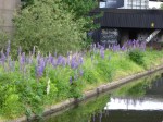
December 9th – A better day today, for sure. For starters, it was dry, sunny and cooler – it felt like a real winter was coming. We’re getting really close now to the winter solstice and the start of the opening out – yet we’ve barely had a true frosty morning. This year has been odd.

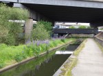
I was further cheered to note that at James Bridge, on the Walsall/Darlaston border, the hard work by planning enforcement officers and the Environment Agency has led to the clearing of the mess here on the field next to the River Tame. It had been in use as a store for general building materials and assorted debris, apparently without planning approval. The whole site looked a mess and seemed to be little more that a glorified fly-tip. 

The site isn’t completely clear yet, although it’s much, much improved. It’s good to see action to remove the blight and a possible source of pollution to the recovering river.

Nice work. Thank you.

May 30th – Under the rumble and roar of Spaghetti Junction, beside a quiet, limpid canal, on an aqueduct above the River Tame, a little oasis of wildflowers in a built, otherwise hostile urban environment of steel, concrete and brick.

Lupins, poppies, ox-eye daisies, red campion.

That’s my Birmingham, right there.

January 17th – Enjoying the ride to work today, I took a spin up National Cycle Route 5 from Station Road in Coalpool up to the Butts, in Walsall. This great cycleway runs mostly beside the Ford Brook, today flowing rather impressively. After passing under Walsall and picking up some tributaries on the way, the brook becomes the River Tame. Where the flow dives under Mill Lane, there’s a debris filter installed by the Environment Agency. Both they and the National Rivers Authority, their predecessors, have done much to clean up this formerly massively polluted waterway, not just here, but further south. I don’t know why, but I always find structures like this vaguely intimidating and unsettling. 

July 27th – Getting of a Walsall train at Bescot, I lugged the bike over the mountainous footbridge and over the river Tame onto Bescot Cresent. Here, the formerly dirty, polluted river runs clean and is lined with greenery. The Ford Brook, which I commented on yesterday, flowing down the Goscote Valley, is a tributary to the Tame and shares the same issue with the invasive, alien plant Himalayan Balsam. Here, it grows tall and dense in the detritus at the side of a concrete culvert. The tinny, metallic smell of the flowers is very strong here, as it will be in lots of damp spaces for the coming month or so.

May 29th – in the seemingly unnamed, orphaned strip of woodland that lies wedged between the River Tame and the canal just north of Hopwas Wood Bridge, the largely disused southern driveway to Tamhorn Park provides a nice green route for walkers and cyclists. Vehicles used to come through here, but not for a few years and the wrought iron gates remain locked, rusting and blocking the track to most motorised traffic. This fallen branch – surely snapped by the weight of the parasitic creepers bound around it – now provides an additional obstacle. 

The cyclists and walkers, however, just wore a path around it…

May 1st – The Tame and Trent through Staffordshire are littered with the remnants of the Second World War, mostly old concrete blockhouses like this one in a field between Tamhorn and Hopwas. It took me a while to work out the logic of the seemingly random placements, but they all cover strategically important bridges. I guess those miltarians who planned gravely for the possible invasion of Britain recognised the value of pinch-points that rbridges formed.

Many of these fascinating structures are now listed, and there’s lots of information including a live gazetteer in Google Earth provided by The Defence of Britain Archive, a project by the University of York.